


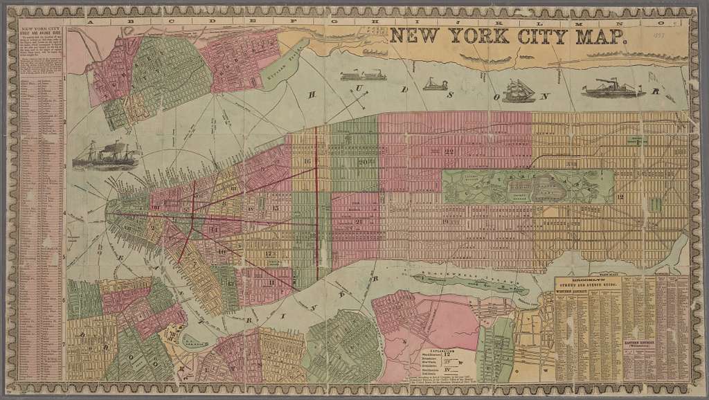

Colton's City & County Map of New York from 1857. The map shows the built-up areas, streetcar/railroad lines, river piers (numbered, proprietors identified), municipal wards (numbered), and projected street-system grid to the northern end of Manhattan Island.
- Stunning Full Colour Reproduction using the Most Advanced Technology Available
- Printed on Museum Matte Archival Paper 310gm
- Unique Conversation Piece for your Home or Business
- Frame not included
- All Sizes in Inches
Here at Old World Prints we use State-of-the-Art technology to capture the vivid colours and incredible detail of these Antique Maps and Prints. Our Vintage Antique Maps include Antique Maps of the World, Antique Maps of the Americas, Antique Maps of Ancient Cities and Countries as well as many Birdseye View Prints of Major U.S. Cities.
We also buy stock a wide range of Wildlife Prints by John James Audubon.
Product code: Vintage buy Old Map of New York 1857